Snow front will paralyze Europe
From Tuesday evening heavy snow is expected in central and northern Germany. The southern parts of Germany can expect "heavy freezing rain".
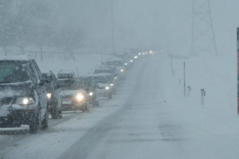
The DWD said the weather will have a "widespread impact on road and rail transportation," and warned of accidents.
The police already reported several minor accidents during the day on Tuesday. Large areas of central Hessen can expect 15 to 30 centimeters of snow within 12 to 24 hours, possibly with more! North of the river Main, heavy snow will also fall in some places.
Freezing rain could fall until Wednesday evening, especially along and south of the Main and Moselle rivers, and there will be the appearance of so-called black ice. The DWD also warned of "extreme ice accumulation on structures, trees, and overhead lines, as well as an increased risk of ice separation."
Low temperatures will range from 6 degrees Celsius on the Rhine to -6 in northern Germany. On Tuesday evening, the rain will change to snow in the south of the country. From Rhineland-Palatinate and southern Hessen to Thuringia and Saxony, up to 15 centimeters of snow will fall.
Snow will continue to fall across the southeast during the day, initially as rain at low elevations, and then the whole landscape will become white.
Temperatures will range from 0 to 4 degrees Celsius, and up to 9 degrees in the southwest by mid-day. Some flight cancellations are expected in Frankfurt and Stuttgart, and school will be canceled in Bavaria.
The storm could spread to the rest of Europe, and the Balkans can expect the same by the end of the week. A sudden cooling with rain and snow is likely
- Log in to post comments